Showing posts with label NC Topsail Island. Show all posts

Thursday, April 30, 2015

NC North Topsail Beach, Topsail Island, Beach Renourishment


    Welcome back to Topsail Island - you can access yesterday's article by Clicking Here.


     We are spending today in North Topsail Beach, the northernmost community on the island
    

     The community is tidy and has its act together in many ways.  There are numerous spots for public beach access with large parking lots and walkways - all of it in great shape.


     Town manager Stuart Turille has only been here two years, but he is having a big positive impact on the community.

Stuart Turille

      "You have to view the beach as a community asset" says Stuart.  And, indeed it is that.  Tens of thousands of people come from many miles to take advantage of the beach, a crucial part of the local economy.  


     As we saw in Yesterday's Article, this entire island is slowly moving south, which means that the north end is where the erosion is occurring.  


     So upon his arrival here, Stuart started advocating measures to combat the erosion issues.  The current project underway that addresses this problem involves moving some 1.5 million cubic yards of sand from an offshore sandbar onto the beaches.


     When the project is finished, some three and a half miles of beach will have been widened.  

     The sandbar lies over a mile out in the ocean, so this is no small project.   Here is a photo of the large dredge, owned and operated by Norfolk Dredging.


    This company opened in 1899, and has completed huge projects all over the east coast and in the Gulf of Mexico including the deepening of shipping lanes in major ports, creating berthing areas for docks, helping construct marinas, putting in large underwater lines and other such projects.


     Large flexible tubing winds its way out to the barge, allowing flexibility of movement as the dredge works its way around the sandbar.  Once onshore, this flexibility is not as important which allows steel piping to be used.  Through these pipes the sand mixed with water is pumped - currently it is traveling about four miles to its discharge point.


     The large pump is onshore - you can see the impeller (blue in color) on the left side of the trailer.  Inside is the diesel engine that drives it.  


     A project this size requires an engineering firm that can act as a liaison between the dredging company, the township, the local citizens, the Feds, the State and the various environmental agencies that are involved.  In this case CBI - Coastal Planning and Engineering Inc. is filling that role.

     This is Adam Priest, who acted as spokesperson for the company at a meeting to update concerned citizens.  Adam has a bachelor's degree in Civil Engineering and a master's degree in Ocean Engineering.


     The project started last year and was supposed to be completed May 10th.  But several challenges have come along that have slowed it down considerably.  The biggest is the weather - it was a bad winter here and the area is susceptible to strong currents.  

     There are numerous government agencies and environmental agencies involved, and the deadline of May 10th was set because of concern about  sea turtle egg laying season.  Adam and his company have been working feverishly with all of the various groups to see if an extension can be secured.  A lot of the agencies have agreed to it, but one or two crucial ones remain.  And you don't pack all this up in a day or two - it will take at least 10 days to break it all down.  

     Public hearings are always interesting, and Adam's demeanor makes him a great choice for interacting with the crowd.  One woman was upset that she can smell diesel exhaust from the tractors when she walks her dog, a point she belabored for the better part of five minutes.  But another expressed her gratitude for how much better the beach is where the work has been completed.

     Another problem emerged along the way.  It turns out that buried in areas of the offshore sandbar there is a lot of ancient fossilized sea life.


      So, solutions to this problem have been implemented.  Above you can see the section where they are pumping onto beach currently.  There are two pipes that alternate pumping.  Here is the valve that allows them to switch flow from one pipe to the other.


   At the end you will notice the "brown boxes."  These are just big cages that trap the fossilized rocks and let the sand and water out.  When the boxes fill up, they are dragged and dumped.


     When they are pumping, a lot of material is flying about.  On a good day they can complete 300 feet of beach - a football field.  But average is about half of that - there are a lot of working parts here and if any one of them breaks, the whole operation grinds to a halt.


     Getting stuff on and off the beach is cumbersome as there are only a few access points that can be used for the heavy equipment.


     On a separate lot they have a large brought in a "powerscreen," a large filtering unit to assist in the removal of the fossils.


     Here are a few of the things that are filtered out -


     a fossilized sand dollar and a regular sea shell I picked off the top of the waste pile.

     On other parts of the beach they bulldoze the sand layer by layer and use machines that screen the dirt as they go.  They can screen down to four feet deep using this method.

     After all this is done, there are horticulture folks who will be coming along to plant sea oats and other local species of plants on the new sections of dune.  The roots of these plants give the dunes a lot more stability.  This is important because the dunes provide the only buffer between the community and the heavy seas that come with big storms.

     All this costs a good bit of money - over $10 per cubic yard of sand, adding up to over 16 million dollars.  The town does not have that kind of money in reserves, so they needed a loan.  Where does one go to get a loan like this?


    It turns out they were able to secure financing from the Department of Agriculture through the USDA - the first time this agency has ever financed a project like this.

     Kim Miller is the loan specialist with the department that they turned to.


     Kim said it was a unique deal to get done - usually loans have something with a title or deed that acts as collateral for the loan.  She was able to push it through - and she did it in about four months.  If you know anything about government financing, that is remarkable.  I have seen simple home mortgages take much longer than that.

     So work is pushing forward - the dredge digging, the pump pushing the sand suspended in seawater flowing ashore, the filtering and the shaping of the beach.   


     This morning I attended the regular town council's meeting.  Here Ken Wilson, also with CBI addresses the group.


     The best line of the meeting came after about a half hour of discussing the various issues that could come up with getting permission to extend work for a few more weeks.  

Tom Leonard

     Mayor Pro Tem Tom Leonard said "Why don't we focus on what we can do instead of worrying about what might happen?"  That moved the meeting forward and everyone agreed to move forward on the assumption that things would work out.  I asked Tom later about his comment, and he said that his father was a fighter pilot who was adamant that you live in solutions.

Daniel Tuman

     Later the conversation turned to body cameras for police.  The town has three cameras, and one or two are often down for repairs.  They have applied for a grant to get enough for all their officers.

     The subject of installing surveillance cameras about town came up, and there were folks on both sides of the issue.  Some felt it helped both police and fire departments on many occasions, others felt that they moved to the island to get away from "Big Brother" constantly intruding.  Someone made the suggestion that the first camera go in the Mayor's bedroom.

     And so it goes - every community faces its issues, but this one has plenty on its plate.  And the beaches are an asset for a town like this - if you take away the beach the tourism goes with it. 


     It serves as yet another example where we get to see folks facing adversity head on and getting creative in their efforts to overcome it.  One photo that kind of tells the whole story here - taken at the town hall.


     Wheelchairs and walkers designed for the beach available for use by the community. 

     Today's "Faces in the Crowd" photo taken at a local restaurant - George and Barbara Bush adorning a pair of slippers.  The perfect gift for someone - maybe GW wears them.


     And today's parting shot, taken from another local establishment:


Click Here if you can contribute a few dollars to help me along the way on this journey, and Click Here to email me.  Click Here to go the the Daily Reflections page.

Have a great Weekend !!
David

Wednesday, April 29, 2015

NC Topsail Island, Topsail Beach, North Topsail Beach, Surf City


     Traveling about twenty five miles north of Wilmington and Wrightsville Beach, we arrive at Topsail Island. The island is just over twenty miles long, and perhaps a mile wide at its thickest point.

     Folklore has it that the name harkens back to the 16th and 17th centuries when pirates were active in the area.  Supposedly, pirate ships would hide behind the island, watching for likely prey to be moving along the coast. 

    Ships at sea would watch for the pirate ships behind the dunes - but all they could see was the top of the mast - hence the name "topsail."  


         There is an uninterrupted run of beach the entire length of the island, and the island itself is divided into three municipalities.  Topsail Beach occupies the extreme southern end of the island, Surf City the middle and North Topsail Beach the upper end of the island.  Much of the architecture on the southern two thirds of the islands is 1940's to 1990's, while much of North Topsail has been built in the last couple of decades.


     A sound runs along most of the back side of the island, and the Intra-Coastal Waterway runs just inland along the full length.  The main entrance to the island brings you into the heart of Surf City, but there is another bridge on the north end.


     Many of the homes on the back end of the island are built right on the water.  Many short canals have been dug into the backside, giving a lot more people access to deep water.


    There are a few spots that have not been developed in this section, but they are steadily being built up.  As you can see, the new construction is all going in on stilts - elevated ten to twelve feet to meet flood zone requirement.

     We meet Howard Batts. 

Howard Batts

      Howard's grandfather purchased about a thousand acres of the island and just inland right after the civil war.  Howard was born in 1939 - World War II broke out the next year.  During the war the US Army took the island over.  Howard says he is unclear if the owners were compensated for the use of the property, but he does remember a ceremony after the war where the government returned the land.

     Howard says the people here were "land poor" - cash resources were scarce but there was an abundance of food.  He recalls that for lunch his father would often pick a bucket of oysters and eat them along with bread.  He recalls that shrimp was so plentiful that as a boy he could get several bucket fulls in an hour or so.

    Some of his funnier stories revolve around alligators.  When he was around eight years old, he went out to the outhouse early one morning, and as he was doing his business an alligator emerged from down in the latrine.  Needless to say that made quite an impression.

     His father started a cleaning business that turned into a going affair - they were running trucks to a couple of nearby military installations several times daily to transport laundry.  They had a pet alligator they kept on a leash that disappeared one day.  It turns out it had hibernated inside of a drainage pipe.  It emerged into the shop one day covered in moss, sending workers into a panic about the "monster" that had emerged.       


     Just inland was the Army Camp Davis, pictured above.  What the army wanted the island for was to practice anti-aircraft firing and to test a new generation of weapons - the RAM jet engine driven anti-aircraft missiles.

     They had women - WACS - fly planes pulling drones that they shot at for practice.  Howard says that he recalls that local women would go out by boat to retrieve the downed drones as the skins were made from a good sturdy silk, and fabric was hard to come by in this area.

     A number of towers were built along the shore for observers to watch the outcome of the tests.  These concrete towers still dot the shore.


     All of the buildings and roads that the Army built became the property of the land owners when the Army pulled out, and they even left the bridge.  Howard recalls that their first cottage on the island when he was a boy was an old converted barracks.  His bedroom was huge, and had several other beds in it.

    Well, his father and brothers decided to turn the chow hall into a dance hall and started hosting dances on the island every Friday and Saturday night, and they quickly became quite the local affair for military personnel from surrounding bases.  At one point his father appointed himself "police chief" in an attempt to regulate activities.   He wore a beret, put a "police" arm band around his sleeve and carried a revolver with no bullets.

     The closest jail was 40 miles away, and his dad wasn't really the "arresting" type anyway.  So Howard often woke up to other folks sleeping in his room - drying out a bit from the previous nights activities.

    But the bridge ran across his grandfather's property, and hence after the war most of the early development was on their land.  This is the middles section of the island, Surf City.


     Most of the work assembling the missiles was done on the south end of the island - simply known as Topsail Beach.


     Following is one of the earlier missiles being winched out of the warehouse they were assembled in to be test fired.


     The missiles evolved over the years the army was here - following is a photo of one of the later models that could follow a radio beacon to guide it and then home in using its own radar when it got close to the target.


     The building in the background of this photo was the "assembly building," where they put together the rockets for test firing.  Today it is a large meeting center and a free museum that is well worth spending an hour or two at.     

     Sill later the RAM jet technology combined with improved explosives allowed a much sleeker design for the rockets.  Here is a cut-away in the museum that shows the components.


     Something else really worth seeing at the museum is a world class extensive collections of sea shells, most of which were donated by long time residents who were avid collectors.


     There are many hundreds of shells, many of them of varieties I have never seen before.


     One of the features of all three towns is a community pier.  Topsail Beach wanted to charge me to walk out on theirs, so I didn't bother.  I am not sure if the other communities charge or not.


     But the fishing is good here.  You can tell by looking most of the fishermen are seasoned.  


      All around town are photos of folks with trophy fish of various species.


     One of the neat things about the island is that it serves as a living museum of beach architectural styles spanning 7 decades.  Here are a few of the older "commercial" buildings that are close to the southern end.


     I love the colors on the ice cream stand.


     Now, I don't know my architecture that well, but I would say this cinder block house is 1950's, if it wasn't a converted military place built in the 40's.


     This is certainly something that could have been built in the sixties - \maybe seventies.


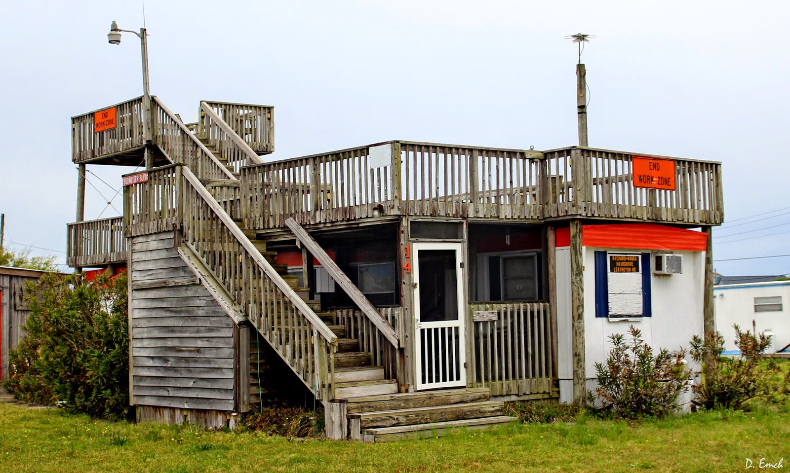
     I have seen "double wide" trailers before, I have seen "double high" trailers before, but this is the first "double decked" trailer I have seen.


     There are a large number of hexagonal and octagonal houses, and even some with ten and twelve sides whatever you call them.


     This one is actually pretty big.  I think I counted 16 sides.


     I am not what you call this style.  Elongated silo maybe.


      I gave up trying to figure out how many sides this next ones has.  


     I bet someone went through more than one pencil trying to draw the plans.

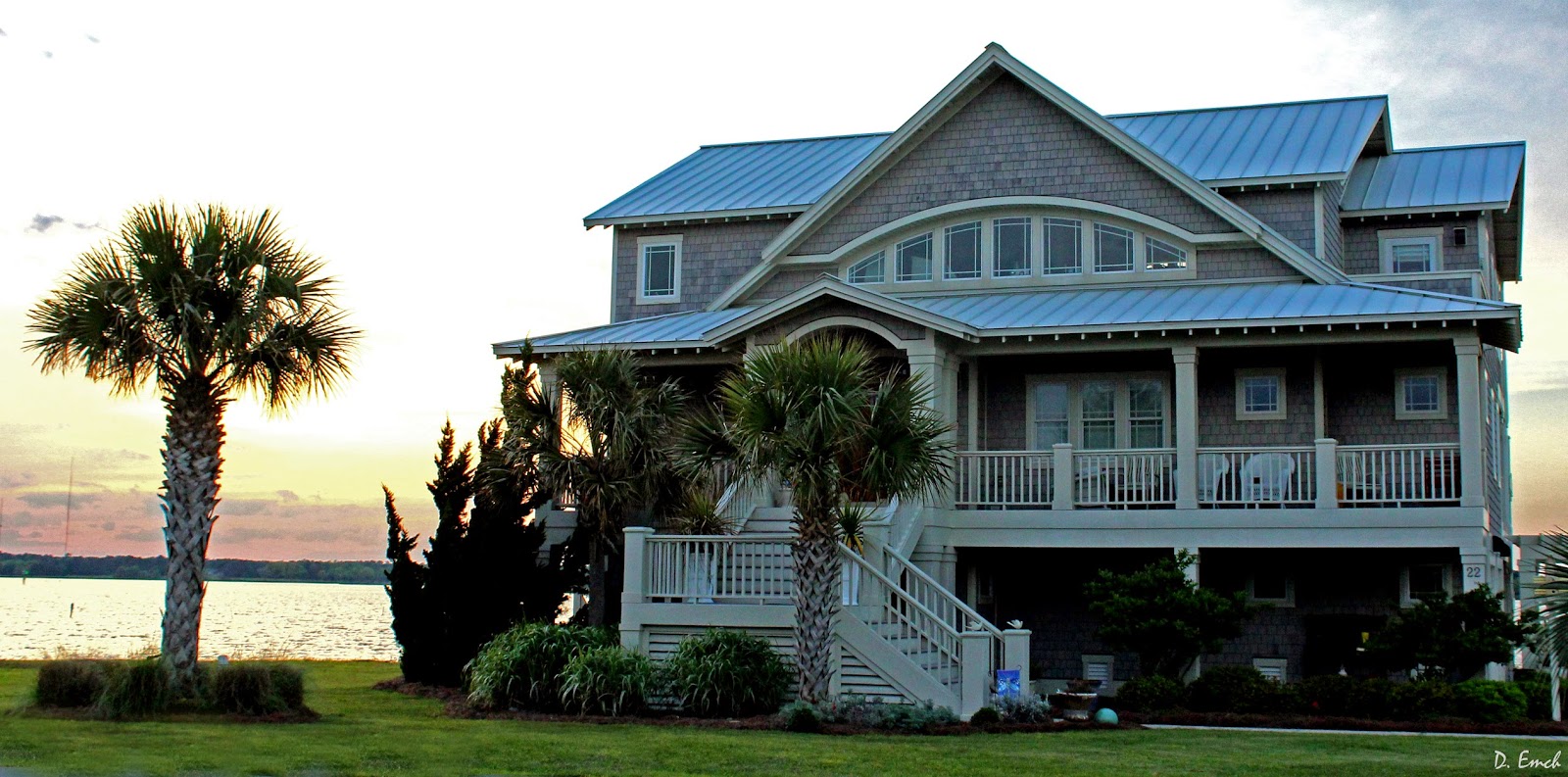
     The most recent part of the island to develop is North Topsail Beach, thus it has many of the more modern homes.


     This next one just looks like an excuse for someone to practice their deck building skills.

     And a few are built right into the dunes on the beach.


     But this is a barrier island, and the coastal environment is ever shifting.  Below is a photo of what was the south end of Topsail Island just a few years ago.


     An area that is accumulating sand is said to be "accreting."  Well, as we have seen time after time on these coastal islands, when something is accreting, something else is eroding.  The next photo is 21 miles north, on the other end of Topsail Island.


     This area is taking extreme measures to try to preserve the integrity of the coast.  Thousands of huge sandbags have been put in place.


     But, nature will have her way.  The highest tides still come in and rob sand, wiping out the structures by undermining their foundations.


     It doesnt take much supporting ground being removed before everything starts tilting crazily.  Plumbing bursts under the pressure, electrical wires are pulled apart - the structure fails an inch at a time.

     In the following photo you can see someone has tied the heat pump up with a nylon strap, trying to get one more season out of the house.  I was actually surprised that some of these weren't condemned.  
     I spoke with a couple of residents, and when things like this are going on folks want to engage in the "blame game."  It doesn't matter to them that they weren't diligent when they built and consider the dynamics of coastal living.  They want someone else to pay for their mistake.  

     On the other side are local, state and federal authorities afraid to step in because they are not sure what changes breakwalls and other measures will bring.  It is only in recent years we have begun to really understand how dynamic these environments are.  

     Attorneys get involved, battle lines get drawn and the air gets tense around these situations.  There are no winners - but hopefully at some point we learn to stop repeating the same mistakes.


     That brings us to today's "Faces in the Crowd."


     And today's parting shot- seen in a local restaurant.


     CLICK HERE if you can contribute a few dollars to help me with expenses, and Click Here to email me.

Have a great Thursday !!
David